GEOMATICS
Geomatics deals with the study, acquisition, restitution, analysis and management of metric and thematic data relating to the surface of the Earth or portions of it. It deals with the natural and urban environment, infrastructures and architectural heritage, described through their position in space and qualified by the precision of the survey.
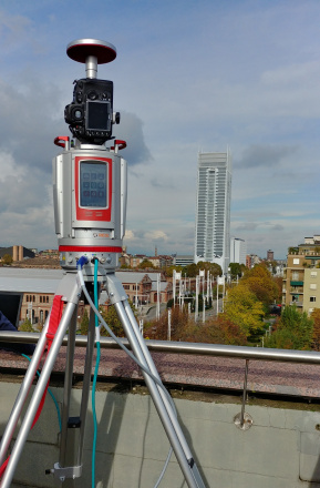
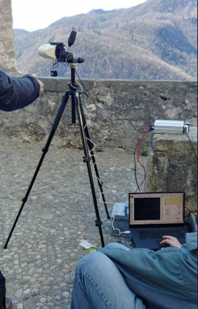
The research activities are based on the field collection and integration of data acquired with traditional topography techniques (such as total stations and levels), optical instruments (RGB, multi and hyperspectral cameras, thermal cameras), LiDAR instruments (aerial and terrestrial), instruments for satellite positioning (GNSS receivers).
The data is acquired and processed with robust techniques and statistically validated for the generation of three-dimensional maps and models that are metrically correct. The techniques analyzed give space to the group's research activities related to, but not limited to:
Indoor positioning (Lingua, Piras, Dabove, Di Pietra): positioning in closed environments using low-cost, ultra-wide-band (UWB) IMUs (inertial measurement units), image-based navigation, use of images for positioning; positioning via devices such as smartphones and tablets.
Visual odometry (Lingua, Piras, Dabove): use of images for positioning in outdoor and indoor environments; integration between images and inertial data to estimate the position of objects and vehicles; solutions for self-driving or navigation vehicles.
Artificial intelligence (Lingua, Piras, Matrone, Belcore): semantic interpretation of data acquired in the form of images (RGB, multi- and hyper-spectral and thermal) and point clouds using artificial intelligence techniques (Machine Learning and Deep Learning).
GIS and WEBGIS (Lingua, Piras, Matrone, Belcore) for the digital transformation of territorial data: development of 3D GIS and WEBGIS also based on open-source platforms, digital ontologies, GIS for environmental analysis (e.g. smart grid, smart mobility) and for cultural heritage, innovative data structures and integration with international standards (INSPIRE, CityGML, OGC).
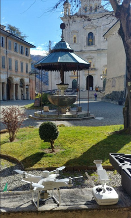
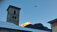
Aerial, terrestrial and underwater photogrammetry using unconventional means (Lingua, Piras, Cina, Dabove, Di Pietra, Belcore): use of unconventional terrestrial and underwater aerial vehicles (Uncrewed Aerial Vehicle, Unmanned Ground Vehicle, Remotely operated underwater vehicle) for the acquisition of data, using different types of imaging sensors (RGB, NIR and multispectral photogrammetric cameras, thermal cameras) and integration with laser scanners, GNSS receivers, IMUs to obtain high-density three-dimensional models of the territory, the city, the environment and cultural heritage. These tools and methods are also used in other innovative applications such as radio astronomy, monitoring of rock faces and infrastructures, estimation of environmental parameters, inspection, measurement and monitoring of infrastructures, monitoring of underwater habitats, ice detection, emergency applications, industrial applications, etc.;
Mobile Mapping System (Piras, Cina, Dabove, Lingua): use of low-cost systems (digital cameras, GNSS receivers, IMU) for high-productivity spatial data acquisition, for example, for applications such as road cadastre and 3D reconstruction. Furthermore, special mobile mapping systems have been developed by the research group, which also allow the acquisition of environmental parameters (e.g. air quality) through the use of bicycles.
GNSS positioning even with low-cost sensors (Cina, Piras, Dabove, Di Pietra): the study of the performance of low-cost GNSS receivers and antennas for atmospheric positioning and monitoring. Develop and implement different positioning techniques to achieve high accuracy and reliability.
Precision agriculture (Piras, Belcore, Dabove, Lingua): use of UAVs for crop mapping, soil analysis and classification, collaboration with robotic systems for crop inspection and treatment, artificial intelligence for the interpretation of multi- and hyperspectral imaging information for the identification of pathologies, parasites and more.
Cultural heritage (Lingua, Matrone): 3D modelling using terrestrial and aerial photogrammetry through the use of UAVs, LIDAR systems, low-cost photogrammetric cameras for 3D reconstruction, scan-to-BIM processes and Historic Building Information Model (HBIM), databases and HBIM-GIS platforms for scheduled maintenance.
Environmental and infrastructure monitoring (Cina, Dabove, Lingua, Piras, Belcore): use of UAV systems, LiDAR from drones, Mobile Mapping Systems from boats, thermal cameras and hyperspectral sensors for monitoring tunnels, bridges, underpasses, natural environments such as glaciers or protected areas such as nature reserves and more.
Statistical data analysis (Dabove, Lingua): use and in-depth analysis of different statistical techniques for processing data acquired through geomatic technologies, robust estimation techniques, complex spatial analyses, and multidimensional spatial regression.
Some members of the group actively collaborate with the laboratories of the cc@polito department of excellence and are members of the Interdepartmental Centers for Service Robotics (PIC4SeR), Virtual Reality (VR@POLITO) and Safety of Infrastructures and CONstructions (SISCON) of Politecnico di Torino.
Websites:
Labs:
|
|
|
|