Photogrammetry and GIS Laboratory
With experience of many decades, the laboratory supports research activities related to the geomatics pipeline with particular reference to:
- “In field” acquisition techniques using terrestrial and aerial laser scanning, aerial photogrammetry also from drones, thermal, multi and hyperspectral sensors (remote sensing) from UAV and Satellite platforms, autonomous aerial, terrestrial, submarine systems, mobile mapping systems for cars, bicycles, handheld laser scanner;
- Processing by digital stereoscopic photogrammetry and structure from motion, spectral analysis and classification systems, fusion and integration of multi-sensor data;
- Complex spatial analysis, segmentation and automatic classification using artificial intelligence applied to images and point clouds (Geospatial AI);
- Innovative, three-dimensional, interoperable and multiscale spatial data infrastructures (BIM-GIS integration) based on existing standards and digital domain ontologies.
The specific, interdisciplinary and multidisciplinary application areas are environmental, territorial, urban and cultural heritage applications with particular reference to rigorous and robust analytical aspects and the trend towards process automation.
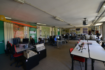
The laboratory carries out educational activities thanks to the significant equipment of high-performance computers and the stereoscopic classroom to share the stereoscopic display for up to 20 users.
As part of the III mission, the laboratory carries out public engagement activities by applying innovative techniques to contexts useful for the public administration, carrying out the drafting of specifications and testing operations for the production of digital map and other geospatial databases and collaborating in forensic investigations.
TEACHING AND RESEARCH FACILITIES
 eBee di Sensefly - Fixed Wing drone with RGB, thermal and Multi spectral cameras
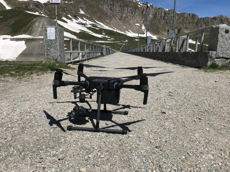 Matrice 300 RTK di DJI - Quadricopter with RGB, thermal and Multi spectral cameras and GNSS RTK systems
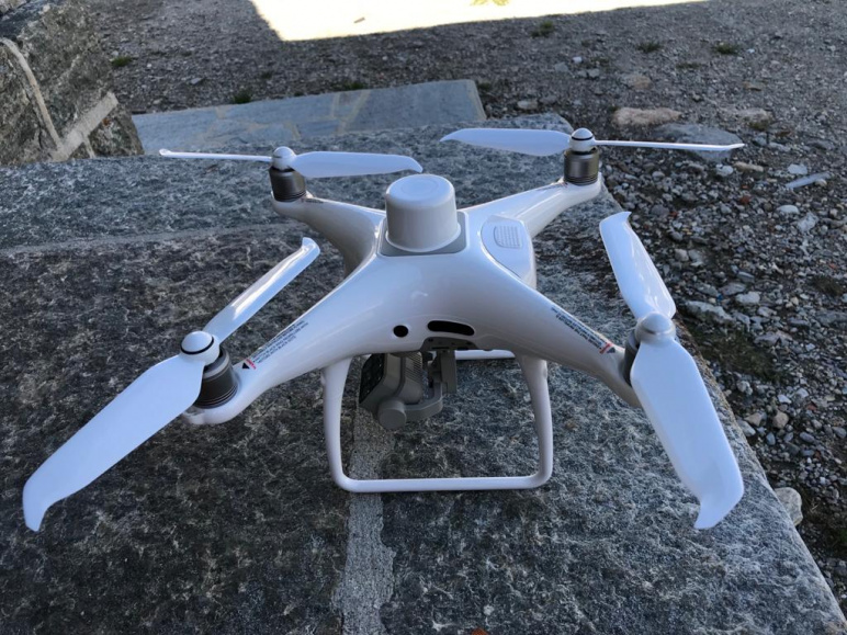 Phantom 4 Multispec RTK di DJI - Quadricopter with Multi spectral camera and GNSS RTK systems
 Phantom 4 pro di DJI - Quadricopter with high resolution RGB camera
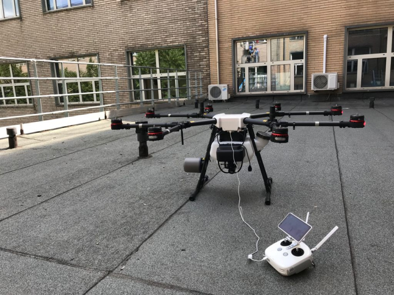 Agras MG-1 di DJI - Multi-rotor drone for high playload
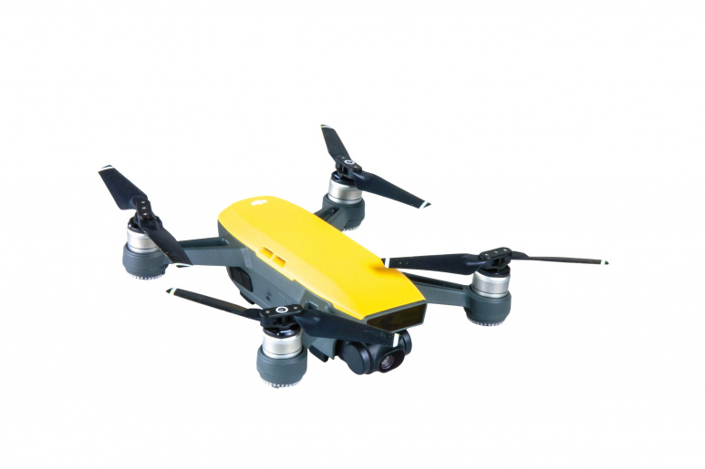 Spark di DJI - Quadricopter drone (high portability) with RGB camera
![]() Leica Absolute Tracker AT403 di Hexagon - Very high precision total station for Industrial application
Leica Absolute Tracker AT403 di Hexagon - Very high precision total station for Industrial application
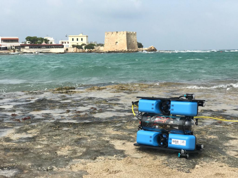 BlueROV2 di BlueRobotics (IREN) con Olympus TG‑6 - Underwater remotely piloted vehicle with digital camera Olympus TG‑6 Kit Open Water Diver
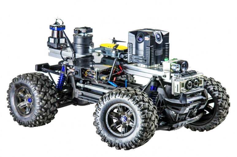 Traxxas Xmax con autopilota PixHawk - Unmanned Ground System based on amatorial vehicle, autopilota Pixhawk e ricevitore GNSS Tersus
 Rikola of Senop - Hyper-spectral Camera for close range applications
 Mini VUX 2 di RIEGL - UAV laser scanner
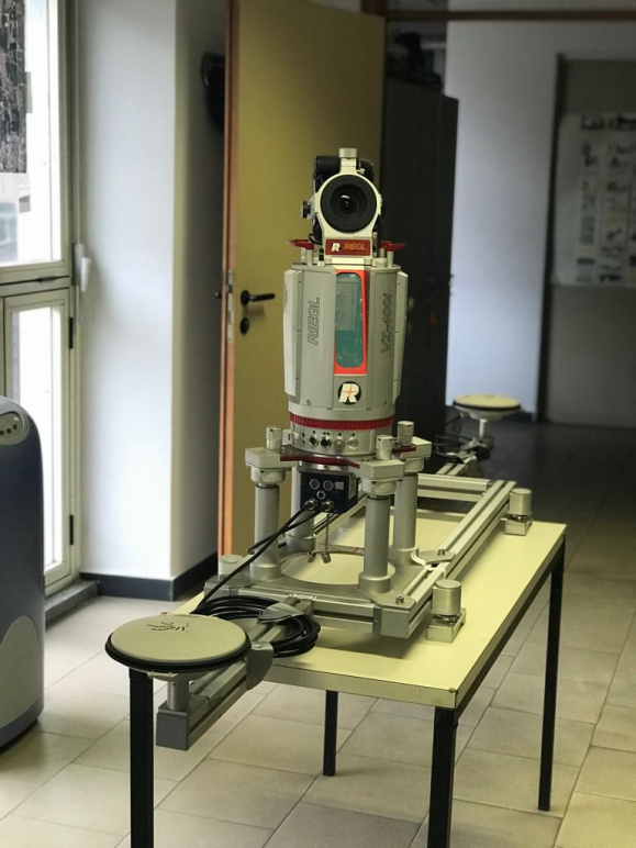
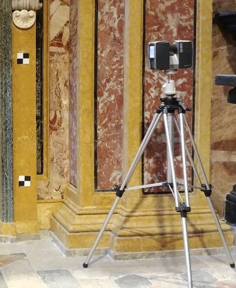
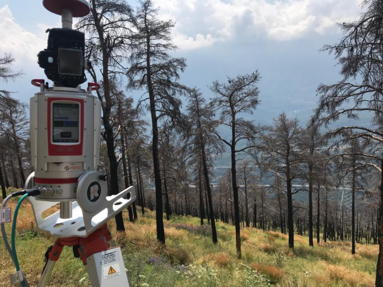 VZ400i di RIEGL - Range laser scanner for terrestrial applications (range 800 m) with online waveform processing
 Mobile Mapping System - Mobile mapping System mounted on car with integration between IMU Ekinox, laser scanner Riegl Vz400i and some digital cameras
 Laser scanner Faro Focus 3D - Range laser scanner for terrestrial applications (range 70 m)
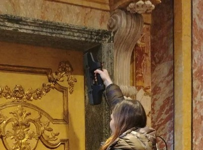
 HandyScan di Creaform - Very high precision triangulator Laser scanner
 MANTIS F6 - Structured light system
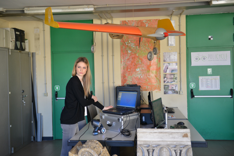
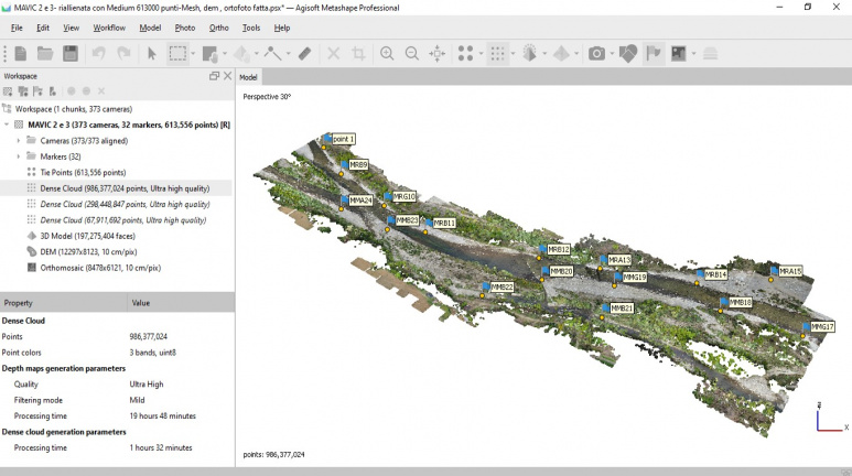 software Metashape di Agisoft - Classroom multilicense (50 Licences) for Structure from Motion software tool
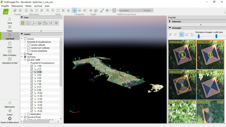 software Pix4D di SenseFly - Classroom multilicense (50 Licences) for Structure from Motion software tool
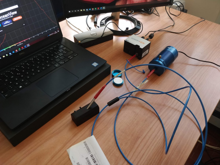 Ocean-HDX-XR di Oceal Insight - High Sensitivity “in field” Spectrometers
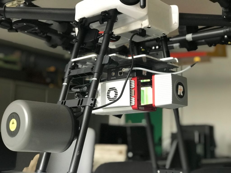
 Slantrange 4P - Multispectral Camera mounted on Matrice 300 by DJI and GNSS RTK system
 Insieme di radio ICOM - A set of Long Range Radios
- eBee di Sensefly: Fixed Wing drone with RGB, thermal and Multi spectral cameras - in collaboration with Team DIRECT
- eBee RTK di Sensefly: Fixed Wing drone with GNSS RTK e RGB, thermal and Multi spectral cameras
- Matrice 300 RTK di DJI: Quadricopter with RGB, thermal and Multi spectral cameras and GNSS RTK systems
- Phantom 4 RTK di DJI: Quadricopter with RGB camera and GNSS RTK systems
- Phantom 4 Multispec RTK di DJI: Quadricopter with Multi spectral camera and GNSS RTK systems
- Phantom 4 pro di DJI: Quadricopter with high resolution RGB camera
- Agras MG-1 di DJI: multi-rotor drone for high playload - in collaboration with cc@MovingLab
- Draco by MUAS: Quadricopter drone with military technologies with RGB camera
- Mavic 2 Pro: Quadricopter drone (high portability) with Hasselblad L1D-20c digital camera
- n. 4 Spark di DJI: Quadricopter drone (high portability) with RGB camera
- n. 4 Mini Mavic di DJI: Quadricopter drone (high portability) with RGB camera
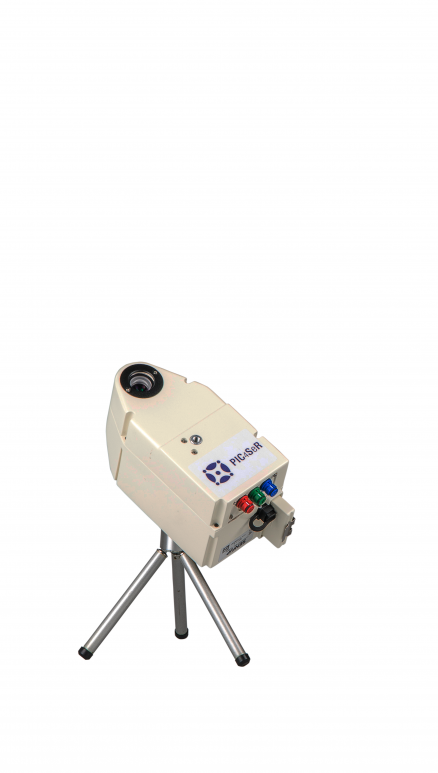
- Leica Absolute Tracker AT403 di Hexagon: Very high precision total station for Industrial application - in collaboration with PIC4SeR
- BlueROV2 di BlueRobotics (IREN) con Olympus TG‑6: Underwater remotely piloted vehicle with digital camera Olympus TG‑6 Kit Open Water Diver - in collaboration with IREN
- Traxxas Xmax con autopilota PixHawk: Unmanned Ground System based on amatorial vehicle, autopilota Pixhawk e ricevitore GNSS Tersus - in collaboration with Team DIRECT
- Rikola di Senop: Hyper-spectral Camera for close range applications - in collaboration with PIC4SeR
- Mini VUX 2 di RIEGL: UAV laser scanner - in collaboration with cc@MovingLab
- VZ400i di RIEGL: Range laser scanner for terrestrial applications (range 800 m) with online waveform processing - in collaboration with vr@polito
- Various digital camera for close range photogrammetry and many calibrated lens
- Mobile Mapping System: Mobile mapping System mounted on car with integration between IMU Ekinox, laser scanner Riegl Vz400i and some digital cameras - in collaboration with vr@polito
- Laser scanner Faro Focus 3D: Range laser scanner for terrestrial applications (range 70 m)
- BLK 360 di Leica Geosystems: Range laser scanner for terrestrial applications (range 60 m)
- HandyScan di Creaform: Very high precision triangulator Laser scanner
- MANTIS F6: Structured light system
- software Metashape di Agisoft: Classroom multilicense (50 Licences) for Structure from Motion software tool - in collaboration with Team DIRECT
- software Pix4D di SenseFly:Classroom multilicense (50 Licences) for Structure from Motion software tool - in collaboration with Team DIRECT
- StereoCAD di Menci Software: Classroom multilicense (50 Licences) for digital steroplotting software
- Ocean-HDX-XR di Oceal Insight: High Sensitivity “in field” Spectrometers
- Slantrange 4P: Multispectral Camera mounted on Matrice 300 by DJI and GNSS RTK system
- A set of Long Range Radios
- Calibration polygon for digital cameras
- FLIR TAU 640: Thermal camera for UAV
- n. 2 Riciclette: Bicycle produced by recycled materials used for MMS - in collaboration with POLICYCLE
- Equipment and dresses for High Altitude and complex environment Survey
| Type |
Teaching and research laboratory |
| Site |
DIATI3 |
| Phone |
+39 0110907666 |
| |
|
| Staff |
Andrea Maria Lingua - Scientific Manager Paolo Maschio - Technical Manager |